

Short answer: A tide chart shows water height over time as a smooth wave: peaks are high tides, troughs are low tides, and the number by each is the height in metres or feet. Most coasts see two highs and two lows about every 24 hours and 50 minutes. The range between them swings on a two-week cycle: big “spring” tides near the new and full moon, small “neap” tides near the half moon. For wind sports, tide matters most through depth, current, and wind-against-tide chop.
Wind gets all the attention, and fairly: no wind, no session. But at a lot of spots the tide quietly decides whether that wind is any good. It moves water on and off sandbars, floods and drains your launch, sets up currents that walk you downwind, and, when it runs against the wind, turns a clean day into a chop-fest. Here’s how to read it and when to care.
How to read a tide chart
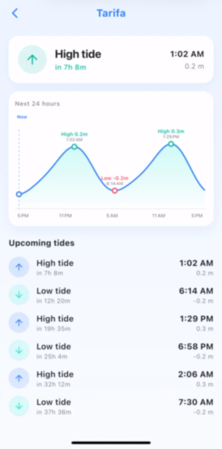
A tide chart (or tide table) is just water height plotted against time. Read across the bottom for the time of day and up the side for the height. The line rises to a high tide, falls to a low tide, and repeats. The number printed at each peak and trough is the height above chart datum (a fixed low-water reference) in metres or feet.
Most of the world is semidiurnal: two highs and two lows roughly every 24 hours and 50 minutes. That extra ~50 minutes is why the tide is about an hour later each day, and why the good tide window slides through the day over a week. As NOAA explains, the timing follows the moon, not the clock.
Three numbers are worth pulling off any chart before a session: the time of the next high and low, the height of each (how much water you’ll actually have), and the range, the gap between them, which tells you how fast the water will move.
Spring and neap tides
The tidal range isn’t the same every day. It breathes on a two-week cycle:
- Spring tides: the biggest range, highest highs and lowest lows. They happen around the new and full moon, when the sun and moon line up and pull together. More water moves, so currents run harder.
- Neap tides: the smallest range, around the half (quarter) moon. The sun and moon pull at right angles and partly cancel out. Gentler currents, less dramatic depth change.
Despite the name, “spring” has nothing to do with the season; it’s from the water springing up. If your spot is current-sensitive or dries out at low water, knowing whether you’re on springs or neaps tells you most of what you need before you even check the height.
Wind against tide: the one every rider should know
This is the tide fact that changes water quality the most. Tidal flow is a current, and current plus wind interact:
- Wind against tide: wind blowing opposite to the current. The moving water and the wind fight, stacking the surface into short, steep, closely-packed chop. Same 20 knots, but the water feels like a washing machine.
- Wind with tide: wind and current running the same way. The water smooths out into longer, more spaced swell. Cleaner, faster, friendlier.
So two days with identical wind can ride completely differently depending on the tide. Flat-water hunters and beginners want wind with tide; wave riders sometimes want it against to steepen things up. Either way, you can only plan it if you’re reading tide and wind together.
When does tide actually matter?
Not every spot cares. A deep, open bay with no real current barely notices the tide. But watch for it when:
- The spot dries out or shallows. Sandbar and reef spots change completely between high and low: a flat lagoon at mid-tide can be dry sand or shorebreak two hours later.
- There’s real current. Estuaries, headlands, inlets and channels can run several knots on a spring tide, quietly pushing you downwind or making your kite or sail feel wrongly powered.
- The launch floods or vanishes. Beach launches, rigging areas and access paths can disappear at high water. Tide timing decides whether you can even get on.
If you kitesurf, windsurf, wing foil or sail a coastal spot, it’s worth learning your specific tide behaviour once, and it pays off every session after.
See wind and tide in one place
The reason tide gets ignored is friction: it usually lives in a separate app or a paper table while your wind sits somewhere else. WindUp puts them together. The home screen shows the next high and low tide and a 24-hour tide curve right next to live wind, the direction, and the AI forecast, so you can line up “is it windy?” and “is the tide right?” in one glance.
Plan around wind and water. Download WindUp: live wind and a free wind alarm that rings the moment your spot fires, even on silent. iOS and Android, no subscription on the alarm. Live tides are part of WindUp Pro.
FAQ
The short version: a tide chart is a height-versus-time wave: highs at the peaks, lows at the troughs, height in metres or feet above datum, two of each about every 24h 50m. Range swings from big springs (new and full moon) to small neaps (half moon). The fact that changes your water most is wind against tide: it stacks chop, while wind with tide smooths it. Check tide and wind together and you’ll stop getting surprised at the beach. New to the wind side? Start with how much wind you need for your sport or the wind speed converter.